Weather can be the single biggest factor in deciding if you’ll have a good day’s fishing – or suffer a bad one.
Weather conditions will dictate if, when, and how hard the fish feed, and will also have a huge bearing on the comfort of the fisherman on the bank.
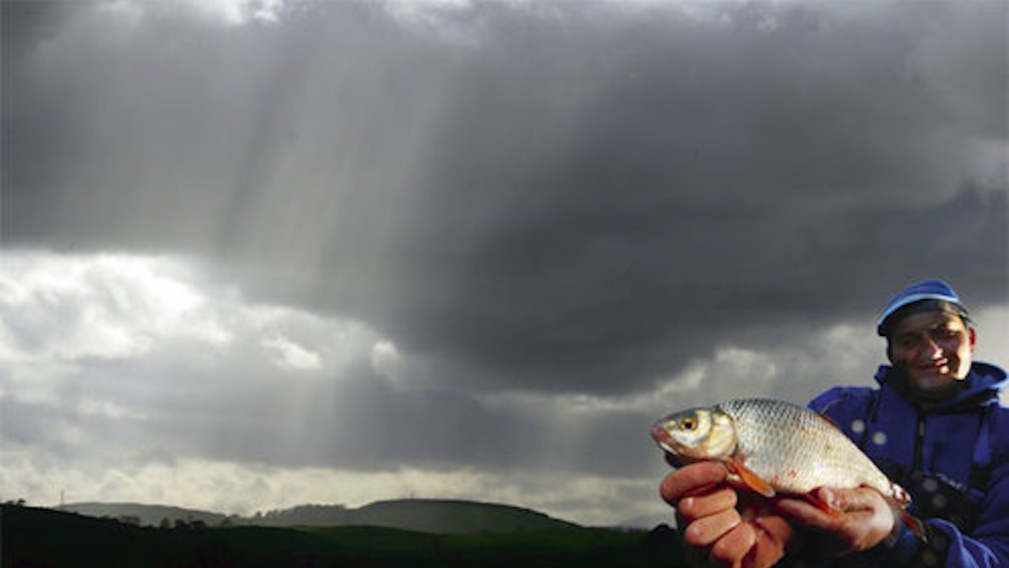
A wet or cold angler can’t be expected to enjoy his or her sport – even if the fish are biting well – but pick your day and plan your trip correctly and you’ll have a great time.
By following just a few simple rules you can turn a potential blank into a late season success to put the smile back on your face.
WEATHER FORECASTING
The weather is the number one topic of conversation for most UK citizens, but how many of us really know how to decipher the forecasts? Next time you see those big charts the weathermen use at the end of the television news, have a close look at the pressure – or synoptic – charts and interpret the ‘squiggly lines’ by looking out for the following.
ATMOSPHERIC PRESSURE
Atmospheric pressure is the force of the air pressing down on the earth’s surface and this pressure has a direct influence on the weather we receive, depending on if it is increasing or decreasing.
Atmospheric pressure is measured in inches of mercury in a barometer, or in millibars (mb) on maps.
In this country, our air pressure is typically somewhere between 980mb (low) to 1030mb (high.)
Points of the same pressure can be joined up to form lines called isobars. These form rings around high and low pressure centres.
ISOBARS
Isobars (squiggly lines) join areas of equal pressure, in the same way contours on a map join areas of equal height.
● An area of high pressure (an anti cyclone) means settled weather; an area of low pressure (or a depression) often delivers wind and rain.
● Wind direction generally parallels the isobars, travelling anti-clockwise round a ‘low’, and clockwise round a ‘high’ (the opposites apply in the southern hemisphere.) The closer the isobars on a weather chart, the stronger the winds.
FRONTS
The heavier lines with small triangles or semi-circles drawn on the leading edges indicate weather ‘fronts’ – a weather system that’s being pushed towards, or away from, the British Isles.
A cold front is the front edge of a colder air mass. It means cloud and a narrow band of heavy rain followed by colder temperatures. It is indicated on the weather charts by small black triangles. The triangles point in the direction that the front is moving.
A warm front – or the front edge of a warm air mass – generally means cloud and an extensive band of drizzle or heavy rain is on the way. It is indicated on the weather maps by black semi-circles that point in the direction the front is moving.

● Low pressure areas are more likely to produce clouds and rain.
● High pressure areas usually mean settled, sunny weather.
● The perfect time to fish most stillwaters in the UK is when a low pressure system is coming in from the Atlantic. This means it will be mild, windy, full of cloud and probably wet, due to the westerly or south-westerly air flow. If you see this weather pattern coming up, get out there because the fish will be getting their heads down to feed.
WHAT FORECAST CONDITIONS MEAN AT THIS TIME OF YEAR

FORECAST SUN
SUN is good at this time of year as it will heat up the top layers and shallower marginal areas of a fishery.
Target these shallow areas in the afternoon when fish have moved into them to feed.

FORECAST RAIN
RAIN can be good if it is mild and warm and brought from either a westerly or south-westerly direction. It can add colour to the water and spark fish to feed.

FORECAST WIND NORTHERLY
or easterly winds are bad at this time of year, especially if they carry rain. They will send air (and water) temperatures tumbling, putting the fish off their food and making fishing uncomfortable for the angler. In these conditions try to find a sheltered swim with the wind off your back. Never fish at the end of a pool with a north or east wind blowing directly in your face. Water temperatures here will be the lowest in the lake.
Remember: The power of the wind (wind chill) can reduce air temperature by 10 degrees C or more.

FORECAST FROST
A SUDDEN, hard overnight frost is likely to put fish off the feed. They may eat angler’s baits in the mid to late afternoon when they have warmed up or acclimatised. Look for the deepest (and warmest) swims to fish in frosty conditions.

FORECAST THUNDER STORMS
OPINIONS are mixed as to whether fish are affected by thunderstorms. We here at IYCF have had some great fishing straight after the most violent thunderstorms. Remember you must be careful in electrical storms. Carbon is an excellent conductor of electricity and you should never use or hold a pole or rod during thunder and lightning storms.

FORECAST SNOW
PROVIDED you have proper clothing and shelter, snow can be good at this time of year. Snow can indicate either a slight rise or fall in air temperature. Snow following a sustained period of frost indicates rising temperatures that could switch the fish into feeding. They have to feed sometime – even in cold weather.
Photographing a good fish you’ve caught in the snow, will also give you a souvenir you’ll never forget.
OLD SAYINGS: IS THERE ANYTHING IN THEM?
TRUE: Red sky at night, shepherd’s delight. Red sky in morning, shepherds warning. Weather fronts often approach the UK from the west, so a red sky at night means it’s clear to the west (you can see the sun going down) and the cloud is clearing from the east. A red sky in the morning illuminates clouds to the west, so predicting bad weather.
TRUE: Mackerel sky and mares’ tails make tall ships carry low sails. The build-up of cirrocumulus cloud (mackerel sky) can often indicate a front approaching, carrying wind and rain.
TRUE: When the wind is in the west, the fish bite the best. When the wind is in the south, it blows the bait into the fishes mouth. When the wind is in the east, the fishes bite the least. When the wind is in the north the fish don’t go forth. South and west winds are warm and mild. North and east are cold and put coarse fish off the feed and make them lethargic.
TRUE: When smoke descends, good weather ends. When a low pressure front is coming, bringing rain, smoke from chimneys will fall.
FALSE: If cows lay down in the fields, it’s going to rain. Rubbish. They’re just tired and chewing the cud!
Reading the clouds
WATCHING the sky can give you a great indication of what kind of weather to expect – if you know what to look for.
The kind of clouds above you can accurately tell you what to expect. Here’s the IYCF guide to clouds, and their meaning.
LOW CLOUDS – UP TO 7,000FT
STRATUS This is white and basically looks like fog. It can produce a fine, penetrating drizzle. If it forms overnight, then it should clear for a fine day.

STRATUS
This is white and basically looks like fog. It can produce a fine, penetrating drizzle. If it forms overnight, then it should clear for a fine day.
CUMULONIMBUS Towering, vertical, dark, anvil shaped at the top. Heavy showers, thunder, lightning and hailstones ahead.

CUMULONIMBUS
Towering, vertical, dark, anvil shaped at the top. Heavy showers, thunder, lightning and hailstones ahead.
STRATOCUMULUS Dark, lumpy, mottled sky with occasional glimpses of sunlight through the gaps. Expect light rain soon.

STRATOCUMULUS
Dark, lumpy, mottled sky with occasional glimpses of sunlight through the gaps. Expect light rain soon.
CUMULUS White and fluffy with dark undersides. Normally large and crowded together. This means showers are possible.

CUMULUS
White and fluffy with dark undersides. Normally large and crowded together. This means showers are possible.
MID-LEVEL CLOUDS – 7,000 TO 17,000FT
ALTOCUMULUS Similar to cirrocumulus, but heaped higher and of a greyer colour – indicates occasional rain or snow.

ALTOCUMULUS
Similar to cirrocumulus, but heaped higher and of a greyer colour – indicates occasional rain or snow.
ALTOSTRATUS A faint haze or sheet of cloud across the sky with sun visible faintly through it – may indicate light rain.

ALTOSTRATUS
A faint haze or sheet of cloud across the sky with sun visible faintly through it – may indicate light rain.
NIMBOSTRATUS A low, dark sheet of cloud that blocks out or diffuses the sun behind it – prolonged rain within a few hours

NIMBOSTRATUS
A low, dark sheet of cloud that blocks out or diffuses the sun behind it – prolonged rain within a few hours
HIGH-LEVEL CLOUDS – ABOVE 17,000FT
CIRRUS White and wispy, formed by ice crystals – these occur in fair weather but indicate a front approaching in 12-24 hours.

CIRRUS
White and wispy, formed by ice crystals – these occur in fair weather but indicate a front approaching in 12-24 hours.
CIRROCUMULUS Known by many anglers as ‘mackerel sky’ these elongated puffs or strips of cloud signify that rain is on the way.

CIRROCUMULUS
Known by many anglers as ‘mackerel sky’ these elongated puffs or strips of cloud signify that rain is on the way.
CIRROSTRATUS White, wispy, almost invisible except for a halo around the sun which indicates increased moisture in the air and rain on the way.

CIRROSTRATUS
White, wispy, almost invisible except for a halo around the sun which indicates increased moisture in the air and rain on the way.

STAY WARM IN THE COLD
